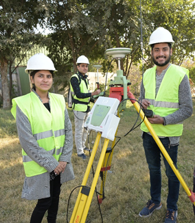
Global Navigation Satellite System (GNSS)
GNSS (Global Navigation Satellite System) refers to a constellation of satellites that provides real-time positioning, navigation, and timing services to users worldwide, enabling precise location determination for various applications such as surveying, mapping, and navigation. It processes data in both RTK and Static Mode
RTK (Real-Time Kinematic) mode is a GNSS technique that provides centimeter-level positioning accuracy in real time by using a base station to transmit correction data to a rover receiver, enabling high-precision positioning for applications like land surveying and construction.
Static mode in GNSS involves collecting data over a period of time (typically minutes to hours) with stationary receivers to achieve high-accuracy positioning by post-processing the collected data, commonly used in applications such as establishing horizontal and vertical control points. The following equipment is available at Survey Lab (SCEE) NICE:
- LEICA GS-10/15 (1 x BASE & 4 x ROVERS)
- ASTECH PROMARK-500 (1 x BASE & 4 x ROVERS)


